Gran Sasso Itineraries
From Prati di Tivo to La Madonnina
| Cartografia | |||||||||||||||||||||||
|
|||||||||||||||||||||||
|
Insert a start address and click to Search button
|
|||||||||||||||||||||||
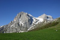
From the main square in Prati di Tivo (1450 mt.) you follow the road that goes to the Laghetta (1600 mt.) dominated by the majestic peaks of the Corno Piccolo and the Corno Grande. Also you may observe all the other mountains that make up the Gran Sasso D’Italia. You can view all the peaks that make up the Centenario Ridge and, in the west, Pizzo D’Intermesoli and Monte Corvo. Once you cross a short plain, you continue up the ridge of Arapietra up until the Rifugio Diruto (1900 mt) and up again still to the Madonnina (2000 mt.). You get back to Prati di Tivo the same way you came up.
Source: CAI Teramo


