Gran Sasso Itineraries
From Castelli to Fondo della Salsa
| Cartografia | |||||||||||||||||||||||
|
|||||||||||||||||||||||
|
Inserisci l'indirizzo di partenza e clicca sul pulsante Cerca
|
|||||||||||||||||||||||
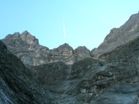
From Castelli, a small village perched on a mountain balcony, you must reach the suburb of San Salvatore, a little higher above from where you can start the excursion (770 m.). The path allows you to see the North Wall of Monte Camicia in all it’s grandeur.
You follow an easy path that climbs through a beech grove, goes past a picturesque mountain pass and reaches the rocky Fosso Morto. Bending to the left, with the steeper path of Piergiorgio De Paulis, you can enter the beautiful amphitheatre of Fondo della Salsa. You can then continue through Fosso Leomogna and reach the monument to the Mountain’s Fallen, right at the base of the North Wall of Monte Camicia, where you meet the Quattro Vada path.


