From Pietracamela to Rigopiano
|
|||||||||||||||||||||
|
Insert a start address and click to Search button
|
|||||||||||||||||||||
It is one of the paths included in the 300 km. of the Bridle way of Gran Sasso and Monti della Laga.
From the village of Pietracamela, climb the unsurfaced road “Sentiero Italia 100” leading to Prati di Tivo and from there, walking on left and running along the asphalted road, arrive to the locality of Laghetta, where the homonymous refuge is.
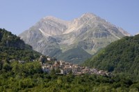
The journey is characterised by visual suggestions of the eastern chain of the Gran Sasso: the majestic Paretone, Mount Aquila, Brancastello, Mount Prena and Mount Camicia, with the famous north wall precipitating vertically on the “Found of Salsa”, 1200 m. lower .
Reached Cima Alta, through a track turning into a path, go down to Forca, di Valle, where there is the possibility to take an interesting detour reaching Tossicia, Azzinanno, Aquilano, Flamignano, Cusciano,and Cerqueto and arriving to Pietracamela.
From Forca di Valle, cross the intersection and turn down the Sentiero 208 in the direction of South, passing under the motorway A24, going down to the valley of the river Mavone and arriving to Isola del Gran Sasso. From here, goig up towards Pretara, you can arrive to the ruins of the castle of the Counts of Pagliara. Left the ruins behind , following the slope , go towards S. Salvatore, from which it is advisable a visit to Castelli, the birthplace of ceramics of Abruzzo. From S. Salvatore, go along the piedmont area overlooked by the walls of the Mount Coppe and, crossing thick woods, you arrive to the asphalted road leading to Rigopiano.


