Gran Sasso Itineraries
From Prati di Tivo to Garibaldi Refuge
| Cartografia | |||||||||||||||||||||||
|
|||||||||||||||||||||||
|
Insert a start address and click to Search button
|
|||||||||||||||||||||||
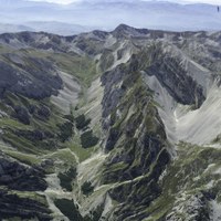
From Prati (1450 mt.) to Rifugio Garibaldi (2230 mt.) passing by the Rio Arno falls, the Mavone Valley and Campo Pericoli.
This itinerary is quite long and varied and crosses one of the nicest valleys of the Gran Sasso. Part of the path is on the Sentiero Italia.
You take the dirt road that climbs up on the left side of the Prati di Tivo Hotel (path CAI 2V). Once you exit the other side of the forest and arrive on the ridge that divides the Rio Arno valley from Prati di Tivo, you continue downhill and once you follow down the steep walls of the Corno Piccolo, you’ll arrive at the Rio Arno Falls.
The road continues uphill and after the aqueduct entry, at the exit of the forest, it turns into a path (CAI 2 path). It follows the beautiful plain under the walls of Intermesoli and you’ll see the Orso cave on your right and the vallone dei Ginepri on your left. Continuing on, the Maone valley widens up towards the east into the vast rolling hills of Campo Pericoli (in ancient times called Campo Aprico – Open Field). The path continues towards the bottom of the valley and after passing the intersection with the path that brings you to Sella dei Grilli, it arrives at the remains of old shepard’s refuges, called le Capanne (1957 mt.). The path continues on, bending to the right and soon after, when the climb gets a little easier, on the right we meet up with a fork that goes towards passo della Portella from where we can get to Campo Imperatore by crossing the Passo del Lupo (2156 mt.). By choosing the left path that brings us through open fields and rolling hills, we eventually reach Rifugio Garibaldi (2231 mt.).
Cartography: "Gran Sasso d'Italia" – path map in scale1: 25.000 - CAI - ed. Selca


