Monti della Laga Itineraries
From Cortino to Macchiatornella
| Cartografia | |||||||||||||||||||||||
|
|||||||||||||||||||||||
|
Insert a start address and click to Search button
|
|||||||||||||||||||||||
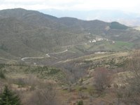
Journey starts at the crossroads leading to Fonte Spugna (m. 1080),over the built-up area of Cortino. Through an easy unsurfaced road you arrive to the “Area Faunistica del Cervo” and “Abetina di Cortino”, keeping examples of over 2oo years old white fir.
Go on meanding through the wood of firs and beech to the top of Monte Bilanciere, where you turn down a mule track leading to Macchiatornella. In a short time you arrive to a drinking trough, from which you go down to the Fosso delle magnanesche.
Arrived to Colle Pozzo, your eyes open on the Alta Valle del Tordino again and, after a steep descendent on the slopes of the hill, you arrive at the built-up area of Macchiatornella (m. 1009).


